Flat Earth Follies: Survey Says...
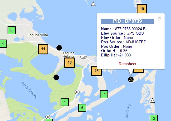
This time around we're going to look at some data using the National Geodetic Survey Data Explorer . I'm just going to pull up some Geodetic Survey marker data for markers lying very near the ocean and we're going to see what shape it describes. You can see the Ortho Height for each marker is under 2 meters. Click on the link in the caption for each image to pull up the raw NGS datasheet on each one. Our first target is down in the very tip of Texas near Port Isabel... NGS DP0739 In this case we find the NAD 83 XYZ coordinates from the datasheet are: DP0739 NAD 83(2011) X - -716,721.076 (meters) COMP DP0739 NAD 83(2011) Y - -5,688,867.995 (meters) COMP DP0739 NAD 83(2011) Z - 2,784,100.512 (meters) COMP Next stop is New Orleans... NGS BJ1342 Where we find BJ1342 at these coordinates: BJ1342 NAD 83(2011) X - -10,884.151 (meters) COMP BJ1342 NAD 83(2011) Y ...