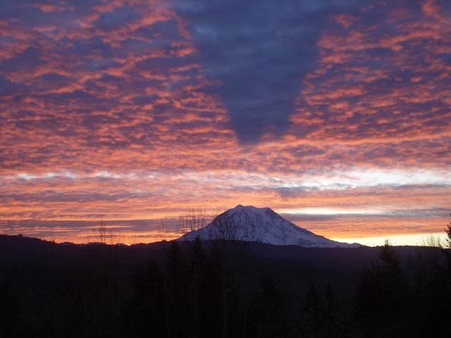
Mt. Rainier's Shadow
This image of Mt. Rainier taken by Shannon Winslow (author of historical fiction in the tradition of Jane Austen) features a shadow that is cast upwards on the clouds with a clear gap between the mountain top and the shadow.
The EXIF data shows:
 |
| Image Credit: Shannon Winslow Blog |
PENTAX Optio S5i | 10.2mm F3.5 1/50 ISO100 | 2011:12:13 08:39:53
This places the Sun over South America, near Latitude: 23° 09' South, Longitude: 70° 58' West as shown by Date and Time -- along a heading of about 134 degrees.
 |
| Date and Time Source |
And since we're right in line with the shadow this puts us Southeast of Tacoma, possibly near the Orting/Carbonado area. But there are no bodies of water Southeast of Mt Rainier that would explain the upward casted shadow.
Much less the EXTREME grasping at straws this represents from the Flat Earth crowd given where the Sun is overhead...
But it makes perfect sense on a Globe.
Indeed, if we pull back as far as we can in Google Earth (which isn't nearly as distant as the Sun unfortunately) we can see this puts that area of Washington right on the edge where it would need to be when we're over the marked spot on the Globe. Funny how that works.
See a bunch more examples on Strange Sounds.


Comments
Post a Comment