Flat Earth Follies: LAX to LHR Flight Path Takes You Near Iceland
YouTuber 'Flat Earth Addict' (a good term for them, they know it's bad for them but they can't quit) wonders why a flight going from the UK to LA passes near Iceland?
NO DUH
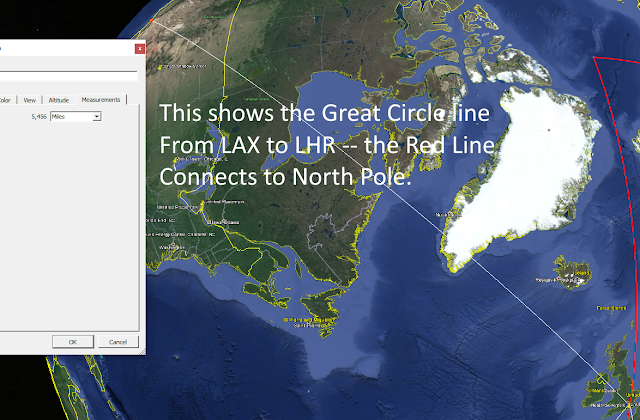
BECAUSE THAT IS CLOSE TO THE SHORTEST PATH ON THE GLOBE
Because both points are well into the Northen Hemisphere his line on Gleason's azimuthal equidistant projection (projection FROM A GLOBE, LOL). Beyond that point the Gleason map IS TERRIBLE -- sizes, distances, compass headings, everything is far worse than on the Mercator projection. The ONLY thing accurate on the azimuthal equidistant projection is distances TO THE CENTER POINT. All other distances are WRONG and they get more and more WRONG as you go further 'South' (towards his outer edge).
Notice how the paths are ALMOST identical? What is this guy trying to prove exactly?
You can find the story, such as it is, here:
Why did American Airlines flight travel 1,000 MILES back to London instead of landing in Iceland after medical emergency?
and a little more detailed here. (sounds like maybe aerotoxic syndrome)
All this proves is that they likely were close to Iceland which fits perfectly well with the Spherical Model Earth.
FlightAware shows the actual flight path on the Mercator projection with a dotted line taking it a little closer to Iceland than a straight-line distance -- this is not usual for many reasons including safety, flight congestion, and legal. The line isn't straight on the Mercator projection because it PURPOSEFULLY distorts areas away from the Equator - BUT it does this to preserve compass directions.


Comments
Post a Comment