Posts

Canigou from 160 miles - a study in 'Perspective'

Image
I do love mountains, so majestic, so easy to spot the curvature of the Earth... Jeranism came out with this abomination : And, of course, I got double-dog-dared on Twitter to explain it (or you know, asked what I thought, same thing but for adults): @ColdDimSum @UnCastellsMes @Rjinswand @JennUndercover @FlatSlugbrains @malo_j @linxalorum @sciencegecko @mabyeez @y0unghusk @FlatRealm @bikinatroll @Erin5549 @Skeptickler @DrMozart11 What do you say about this video? https://t.co/sVlHmcwigy — ISHAQ (@badassack) May 11, 2017 I have to say I was SHOCKED -- SHOCKED I SAY -- to find Jeranism didn't just lie about the distance.  Video says 160 miles, he uses 163, but it's maybe even 166... I dunno for sure.  If I want to "100% PROVE, R.I.P. Globe" I would use a video where I could authenticate all the data but I digress.  It *seems* to be about 163 miles from 43°20'11.34" N   5°29'08.53" E at about 310 meters elevation.  I don't know, Jerani...

Mea Culpa -- I was wrong! True Shape Of The Earth Revealed For The First Time Ever!

Image
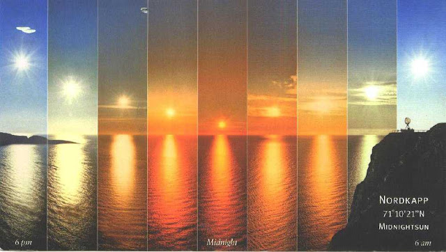
This is the blog entry all the Flat Earthers have been waiting for, I'm sure. I was wrong, mea culpa... My eyes have been opened. I am so W*O*K*E now I see it. The truth was there in front of me the whole time -- in a can Of Pringles True Shape Of The Earth Revealed Yes, it's true.  The Earth is clearly Pringle shaped! It finally hit me watching all the high-altitude balloon footage. I mean come on! One direction it's curved up - another it's curved down.   100% proof. THERE IS NO OTHER WAY TO EXPLAIN IT  (cuz I said so) Zetetic! Oh, and I also discovered that NASA is hiding 1000's of additional Suns with their space laser hologram technology but every once in a while we see some of the true Suns when their laser refreshes like we see with the Moon Hologram (LOL @ globulists thinking that's just jet wash! gullible NASA-holes AMIRT) Think about it - the Dome Perspective Vanishing Point is the only way to explain what see. Because I defined it that way. And we can...

Flat Earth Follies: Railgun shoots Line Of Sight

Image
Flat Earth Claim Railgun shoots Line Of Sight. and Reality Sorry, but US patent 7526988  [ view pdf ] says otherwise. Basically, this one has fins and a flat side so it can steer a little bit instead of being on a fixed arc. Can see the flat side and deployable fins here: So, in classic form, Flat Earthers just flat out lie again . And this page Electromagnetic Rail Gun Proposal Shows the elevation is about 75 ° And the "100 mile" projectiles go 70km and they seem to plan to go 150km up to get 240+ mile range.

Flat Earth Follies: The Sun Changes Size, proof of nearby sun!

Image
Flat Earth Claim The sun is smaller on the horizon proving it's simply further away and nearby: Wow, that's really compelling evidence, right? Reality Do those look like consistent exposures to you? They sure do NOT look consistent to me. Here is what happens when an object is too bright for the sensor (this is the moon, I personally took these images changing ONLY the exposure to show what happens): I've been accused of 'faking that' by zooming in - whatever, I've replicated it several ways and I'll include another example I found online - and more importantly - if you don't believe it then YOU take the pictures yourself. Here you can see the same effect with this lamp.  Brighter light overwhelms the sensor and makes a big white blur. Here is a series I took in an airport: You can clearly see the 'bright spot' is significantly larger from the darker exposure.  This is PHOTOGRAPHY 101 stuff. So I'm sorry but you'll need to do better with ...

How Compton computed Latitude, direction to North, and length of a day

Image
Thanks to @FlatSlugbrains for finding this one on the Copasetic Flow blog . How would you do such a thing on a non-rotating Flat Earth with no gravity? You couldn't even reliably find "down" because, if density determines motion as Flat Earthers claim (and which NO Flat Earther has ever actually shown evidence for, and we know this isn't true from experiments such as observing a density tube in absence of gravity ), then changes in lateral density should cause lateral forces on a body making it impossible to reliably find "down". Arthur H. Compton built such a device and published his results in Phys. Rev. 5, 109 (1 February 1915) entitled "A Determination of Latitude, Azimuth, and the Length of the Day Independent of Astronomical Observations" ( DOI ) [backup link , Google Scholar Search ] His paper details the methods and calculations but for the purpose of this exercise it would be sufficient to simply observe the water consistently rotating i...

Water Finds Its Level - Ocean surface topography reveals ocean floor topography

Image
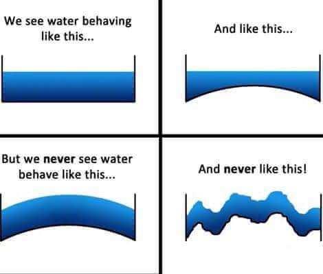
You'll see a lot of Flat Earth memes that talk about 'Water finds its level" There are hundreds of projects where they use radar altimetry to measure the ocean surface very accurately and this surface, in turn, reveals the shape of the ocean floor. This works because the shape (or topography) of the ocean floor means the gravitational pull is different in that area because of changes in the density -- this is then reflected in the shape of the surface of the water. Scale is exaggerated Image credit:  NOAA: Datums, Heights, and Geodesy So water does indeed fine its level - but that "level" is defined by the spherical gravity of the Earth and all the micro variations therein - and we can measure them and verify those measurements by comparing them with other methods of measuring the ocean floor topography. This map of the ocean floor is one such result of mapping the ocean surface topography: Image credit: NOAA And Image credit: global marine gravity model from Cr...

Yet Another CN Tower from Olcott NY Flat Earth claim fails to hold water

Image
I'll be honest, I didn't put much work into this one as it is blindingly obvious I'm embarrassed for the person who cited this as their 'proof'. This YouTube video  is supposed to 'prove' the Flat Earth.  Looks like a bad remake of Waterworld to me. What kind of non-thinking individual can fail to see that almost the entire city is completely and utterly missing and behind the horizon here.  The horizon is very crisp and nearby reducing a lot of the near-water distortion you would otherwise see: Anyway, here is my quick analysis... We see about 1/2 the tower -- we would expect to see about the 1/2 the tower. WE'RE DONE. With the complete lack of information in the video that's about all we can say and I have no interest in digging further because I've done this over and over now. If you want a more exact analysis give me EXACT Latitude, EXACT Longitude, EXACT Viewer height (not this 'about 6 feet' nonsense -- EXACT height of the center of...